Sunday, May 09, 2010

THE STRANGEST NATIONAL PARK

Without a doubt, Hot Springs National Park is the nation’s oddest.  It claims to be the oldest national park, having been “set aside” as a reservation in 1832 by the federal government to protect the purity of the water, but little effort was made to establish boundaries.  Claims to seeps and springs sprang up all over, the town of Hot Springs encircled the reservation, and by the 1870’s the government had licensed private bathhouses to be erected along Central Avenue, now known as “Bathhouse Row.”  In 1921, Steven Mather, the first director of the National Park Service, convinced Congress to make it the 18th(!) national park.

So, what is it?  It’s just a row of restored classic bathhouses, but only one is still operating.  The rest are just pretty faces, although some are in the process of interior renovation for future operation.  The old Fordyce House, dating from 1915, and renovated n 1989, serves as the park headquarters, where I relax:

IMG_2382

The “Row” spreads out on both sides of the headquarters.  Here’s the north end:

IMG_2384

The Park occupies only this side of the block; the other side is an unbroken row of the sleasiest souvenir and trinket shops you’d ever want to avoid.  Rather sad that the period elegance has to face modern blight. 

The headquarters building has been renovated back to period authenticity, and it’s a hoot to see how folks came to “take the waters.”  The equipment verges on the Star Chamber, with soaking tubs, needle sprays, virtual fire hoses, and Frankenstein’s lift (below):

IMG_2380 IMG_2373 

The facilities were gender segregated, and the men’s side always was much more elaborate than the distaff.  The women’s basically looked like the rooms above, but the men languished in splendor.

IMG_2374

IMG_2375

IMG_2377

Boorish behavior was frowned upon:

IMG_2378

Yeah, mind that vapor!  The water itself is ancient stuff.  Scientists have determined that it fell as rain over 4,000 years ago, percolated downward through the rock, getting heated at +4 degrees F for every 300 feet it dropped.  It’s not heated volcanically, but rather from the heat generated from radioactive decomposition! Eventually, the seeping water meets faults in the sandstone which leads to the surface, and rises up, emerging at 143 degrees.  There are fountains around town where you can fill a jug or take a sip.  It’s odorless and tasteless, so what the heck:

IMG_2385

Maybe it’s a fountain of youth?  I could use one.

Saturday, May 08, 2010

INTERSTATUS INTERRUPTUS

Finally, we got off the interstate.  We had been on I-40 ever since California only to get east as quickly as possible.  As interstates go, it’s probably as nice as any, but it’s still just a high-speed corridor, with very little local color.  Well, high speed for everyone but us.  We kept it at about 61 mph to try and save on gas.  That makes for longer hours and fewer miles covered per day, but it got us to OKC.  We left OKC Saturday, and jumped off I-40 on SR99/US377 (it seems like most roads have more than one designation in these parts), about 52 miles east of OKC.  This took us south to the town of Seminole, which sported brick streets in the old downtown area.  That sounds cool, but try driving on them with 13,000 pounds of weight on hard tires.  I imagine the road to Chaca Canyon is smoother.

One nice thing about the interstate is that everyone else was doing the passing, of us.  On the backroads, it’s another matter:

IMG_2358

We saw him pull out onto the road when we were about a block away.  Timing is everything.  See those double yellows and blind dips?  They continued for the next ten miles.  And there we crawled.  Eventually we got around him and motored on down US270 to the metropolis of McAlester, which, I am sure, has Napa quaking:

IMG_2359

After our experience with Indiana wineries, we weren’t tempted.

All smirking aside, having gotten off the interstate, we felt our real trip had finally begun.  The backroads are the best.  Farms, ranches, the full range of houses from decrepit to wowser, small towns thriving and decaying.  We love it.  Our goal is to avoid the freeways as much as possible.

Our first stop was Talimena State Park at the beginning of the Ouachita (I don’t make these up) National Forest. As it was late afternoon, we decided to stop here and then do the Talimena Trail the next day.  That’s a scenic highway touted in the guidebooks.  Of course, what they tout are the fabulous Fall colors.  It’s Spring.  First things first, however.  We had purchased a vent cover at the Camping World in San Bernardino.  With that, we could keep the vent open when it rains and keep the fan going to circulate the air.  The park hosts have disappeared for the night, so I could work without officious interruption.  For once, the directions were reasonably clear and complete, and all parts were in the attached baggies.  A few holes drilled, brackets attached,

IMG_2361

and we were good to go.

IMG_2362

Loni was happy I didn’t trip on something and pitch off the roof.

IMG_2363

It got its first workout that night, as the rains we were trying to keep ahead of showed up about 2 a.m., with ferocious sounding winds and the clunks of unknowns dropping on the roof.  No leaks, so I claim success.

After using the park’s deliciously hot showers the next morning, we set out for the scenic drive.  It’s actually quite beautiful once you get up to the vista points; otherwise, it’s a pleasant drive through dense pine/hardwood forest where you can’t see anything but the trees on both sides of the road.  After the rain last night, there was a lot of fog and mist down below. 

IMG_2366

Loni is standing, believe it or not, on “Choctaw Ridge.”  Where’s Billy Joe?  We couldn’t get that darn song out of our heads for the next hour.  We kept climbing and the mists kept rising.  It was a great road:

IMG_2368

Unfortunately, once we got to the halfway point (between Talihena and Mena) at the Queen Wilhelmena State Park, the fog really closed in.  We couldn’t see more than 50 feet for about 20 miles.  Win some, lose some. 

That night’s destination was Hot Springs, Arkansas, boyhood home of good old boy, W.J. Clinton.  There are a number of RV parks in the area so, not knowing one from the other, we naturally chose the one the farthest away.  We were disbelieving Dora when she kept having us turn and drive seemingly endlessly away from Hot Springs.  We finally got to Lake Catherine State Park.  Despite all the driving, it turned out to be a gem.  We landed a space that we could back into with a three-side water view.

IMG_2372

Arkansas campgrounds so far appear to be beautiful, well laid out, and clean.  Boy, could California take a few (dozen) tips.  After settling in, we took off on a hike to the local falls, across the galloping Gertie swinging bridge

IMG_2370

and to the . . . falls?

IMG_2371

Friday, May 07, 2010

COWBOYS AND CRACK

IMG_2349

We woke up today to more of the same.  The musical “Oklahoma” got it right with that “where the wind comes sweepin’ down the plain” refrain.  That might be the least of our worries.  Severe weather due this week, bad enough that the local t.v. stations are advertising their emergency service where they’ll text you with warnings of tornados, severe hail, etc.  Yikes.  Give me California earthquake anxiety any day.

Not wanting to risk getting blown clean off the scoot, we unhooked and drove the rig over to the National Cowboy and Western Heritage Museum.  This is a very neat museum that we raced through on our last trip here a year ago.  It’s well worth spending a day, and there’s more than enough to keep you interested.  The current special display was all about guitars and they had some absolute beauties from Gibson and Fender, as well as other makers.  Nice history of the instrument as well.  Did you know the ukulele craze towards the end of the 19th century was largely responsible for saving the Gibson company and sparking new interest in the guitar?  Thank Hawaii for today’s picking and strumming.

They have some great dioramas:

IMG_2351

IMG_2353

IMG_2355

displays (besides hats, barbed wire, boots, spurs, guns galore, clothing, etc.)

IMG_2350

They didn’t allow photos of the extensive art collection, but they had a wonderful collections of contemporary and period western artists like Russell, Remington, etc.  Great stuff.  There’s also a trip down memory lane with a room paying tribute to the celluloid and videotape cowboys.  Everyone from William S. Hart to Clint Eastwood with, of course, a huge section devoted to John Wayne.  As you would imagine, he’s somewhat more idolized here than, say, on the coasts.

Oh yes, the crack.  Referring to the windshield, not the stuff.  Tried the do-it-yourself fix today with a kit bought at Wal-mart.  Some sort of epoxy resin that has to be applied in the shade to the crack, worked into it by pushing the glass on either side, then plastering clear plastic covers over the goop.  When you’ve supposedly squoze the air from the crack and replaced it with the epoxy (say, WHAT?  Squeeze the windshield?), you maneuver the vehicle so that the crack is exposed to the U.V. rays from direct sunlight.  Well, all I’ve got to say is don’t try this at high noon with a Class C RV.  For the uninitiated, those are the ones with the bed area that hangs out over the cab and windshield and . . . blocks the sun.  We were in the remote parking lot at the Museum, so I drove all over trying to get some light on the thing.  No dice.  Parked it facing SW and went back to the Museum for the afternoon.  When we came out the sun was lower, and I could back down a slight hill so we were nose up.  The sun just barely reached the crack, so we let it sit there and cook.  Now we’re back at the RV park, peeled off the plastic, and    there’s    still    a     crack.

The only thing to do is to head for the County Line BBQ Restaurant, gorge down on a ton of meat, draft beer, and a mountainous brownie-ice cream-kahlua concoction.  Gustatory solace.

We’re headed into more remote territory in western Arkansas, so we most likely will be off the internet grid for a while.  Now, just where is the nearest storm shelter?

Thursday, May 06, 2010

THE LONG AND WINDY ROAD

That’s a short “I,” not a long one.  As in GALE.

IMG_2346

That’s a big flag, standing straight out.  Unlike our course of progress, which had more weaves, zigs, and zags than Gayle Sayers swiveling through the defense.  We hit the Oklahoma border

IMG_2344

and the winds, previously a friendly push from the rear, shifted to a 90 degree 40mph broadside, with frequent, higher gusts.  LD’s are much better drivers than just about any other class “C” on the road, being significantly lower in overall height, but these winds were something else.  We were dancing, and out of step.  Other than a two hour fight with the elements, not much else to report.  Flat, flat country.  However, that is a plus if your goal is to make visible from long distances the thrill of . . . THE LARGEST CROSS IN THE WESTERN HEMISPHERE!  That’s what the billboard said.  And who are we to argue?

IMG_2340

Not convinced?

IMG_2343

Those are people down around the base, some cars on the right, for perspective.

Only in the Bible Belt.

We now sit in the Twin Fountains RV Park in NE Oklahoma City, a very nice park where the wind still blows.

IMG_2347

Personally, I need a drink.

Wednesday, May 05, 2010

BAD DAY AT BLACK ROCK

Some days are just like that.  Things go wrong.  Dehydration and altitude make you feel crappy.  Yesterday was a bummer for both of the foregoing.  We didn’t think twice about spending all day at 7,000 feet – it’s not that high, not like mountain climbing.  But, we foolishly were not drinking enough water, and by the end of the day we both were feeling lousy and snippy.  Then we tried to check emails at last night’s stop, the Enchanted Trail RV Park (the name belies reality, big time) on the westernmost outskirts of ABQ.  The Vaio through a fit, froze, wouldn’t even turn off, and I finally pulled the plug.  Tried to restart and it wouldn’t boot.  Black screen of death.  Then a small window popped up saying something like “security module failed to initialize.”  Yikes.  When working with Windows, the last thing you want to hear is a security problem just after you logged onto a strange wifi network.  Anyway, nothing I did would get the thing to fire up.  A foul mood got even blacker.  Loni retreated to the other end of the rig.  I put it away and began planning a trip to some computer shop to put things  right.  Then, we thought we’d go out and drown our respective pains in margueritas.  I remembered a place from my FTC visits here 35 years ago that I knew was still in business – El Pinto.  It was over 20 miles from the RV park, but we’d make it fine on the scoot.  Wrong.  All day long the radio was warning about strong winds on the way.  They were right.  We stepped outside and nearly lost the door.  The trees were bending WAY over.  Scratch that idea.  Loni zapped some enchiladas she had frozen from a previous meal, we cracked two beers, and made the best of it.  We also drank a lot of water.  I went outside to check that everything was secure and saw . . . the CRACK.  As we were trundling along behind some oaf today, he threw up a rock that we heard hit like a shot, but saw nothing.  Turns out it had hit at the very bottom of the windshield, hidden from sight below the dash cover.  Now, it had spread into a scythe shaped crack about eight inches long.  Great.  Just great.

Today dawned and we both felt a lot better, took a walk around the area, had breakfast, put everything away, and hit the road.  Maybe the crack won’t spread.  Right.

We bombed through downtown ABQ with no problem, as it was just after rush hour.  ABQ is at about 5,200 feet or so, and again we climbed, back up to over 7,000, all the while glugging water faster than the rig was gorging on fuel.  The scenery was ok, but not spectacular:

IMG_2318

Just as we were exiting New Mexico, there are huge rock formations that are pretty neat:

IMG_2323

They were the site of a host of fascinating attractions:

IMG_2324

But we restrained ourselves from hanging a uey.

We found the Stimulus funds found their way to N.M., as much-needed roadwork was underway everywhere:

IMG_2328

New Mexico wasn’t going to let us go without some more spectacular scenery:

IMG_2331

Alas, it was not to last.  I’ve never seen so much flatness:

IMG_2334

At last we came to the real reason for this trip:  a pilgrimage to the site of my beatification:

IMG_2335

Darn.  If only I could photoshop a halo:

IMG_2338

Finally, New Mexico bid us adios, and the official Texas welcoming party made us feel right at home:

IMG_2339

We’re in Amarillo, ensconced at the “Fort Amarillo RV Resort,” which has the cleanest and most modern bathroom facilities we have ever encountered in all our road travels.  They’re even nicer that the Hyatt we stayed in a couple of weeks ago!  And, as you can see, sleeping it off seems to have cured the cranky computer.  The crack, however, grows larger.  Film at eleven.

Tuesday, May 04, 2010

HIGH PLAINS DRIFTERS

Did our morning walk around the Avi grounds, fixed breakfast, and were on our way at 9:30.  Quite a bit better than yesterday.  Crossed the Colorado on the bridge that leads to the casino.  The Colorado is surprisingly clear and blue, even at this far downstream location.  It’s no wonder that thousands of boaters head out here year round.  The scenery changed a bit for the better as we again started to climb out of the Mohave Valley (el.475) towards Kingman, over Union Pass (el. 3625).  Dragging 13,000 pounds up those long grades really sucks the tank dry.  Every fill-up requires two passes with the credit card because of the transaction limits.  As we chugged up, we had plenty of time to look around at the rocks.

IMG_2307

That was just the start.  I don’t think we ever stopped climbing all day long.  AFter Kingman, we dragged over the Cottonwood Cliffs to a higher plains elevation.  The bright spot was that we started picking up a great radio station allegedly broadcasting out of Seligman.  All classics and hardly any commercials.  We rocked to Boston, Beetles, Creedence, and Gracie belting out White Rabbit.  FEED YOUR HEAAAAAAAAD!  I say allegedly, because we succumbed to the siren seduction of a frosty mug A&W sign and pulled off into Seligman.  Hmmm.  This is very flat country.  No radio tower.  No mountain top location.  If that station is broadcasting from here they’re doing it stealth style.  As for the A&W, no mug, cardboard cups, and a surprisingly cloying sweet taste.  Did we change or did A&W?  Seligman is no more than a single street, probably part of old Route 66.  The shops are, well, eclectic.

IMG_2308

More climbing out of Seligman, up to the Kaibab National Forest approaching Flagstaff.  I discovered the altitude function on Dora, so we played games.  6,995, 6996, 6998, will we make it???, 6997 . . .  Hey, you take your amusement where you find it.  We did eventually get to, and stayed over, 7,000 feet for quite a ways.  We lost the Seligman station but switched moods to the classical offerings from KNAU (Northern Arizona University), and gave a wave in honor of Meghan’s undergrad years there (son John’s lady).  The scenery definitely picks up here, with the snowcapped Humphrey’s and Hendrick’s peaks.

IMG_2310

We left this good stuff behind and started in on the high plains again towards Winslow.  We began seeing signs advertising Meteor Crator (“The Best Preserved Meteor Impact Site In The World!).  It was also listed as a National Monument, so we took a detour off I40 to check it out.  Yikes.  It’s NOT run by any government agency, but is a private tourist, eh, trap?  Anyway, when we got there and saw the $15/head entrance fee, we decided to pass on the big hole.  From the pictures they foolishly posted out front, we didn’t miss a whole lot.  Instead, we took a picture of Albatross in their parking lot.

IMG_2313

We pushed on to Holbrook, self-proclaimed as the most rugged and lawless town of the Old West.”  It’s pretty tame now; actually, rather lifeless.  It does sport the OK RV Park, which we highly recommend.  We need to hire this bunch to clean OUR bathrooms back home!  Excellent wifi, cable, and full hookups for $26.  Today, it’s on to Albuquerque.  We are looking forward to dinner at El Pinto, which I first frequented back in my 1970’s FTC days prosecuting land fraud in those parts.  I suspect you can’t go home again, but we’ll give it the old marguerita shot. 

Monday, May 03, 2010

WE’RE OFF!

No, we don’t smell like old fish.  After months of pretending to plan, and a frantic last week where we actually got started doing so, and washed and waxed the rig, installed new electrics to monitor the batteries (why are those lights dimming?), prepped the house for getting along without us for a couple of months, and generally exhausted ourselves (this is supposed to be fun, right?), we are off!  Southeast U.S., here we come.

We were supposed to leave Sunday morning, but . . . first the farmer’s market for last minute provisions, Gelson’s for some breakfast buns (yum), last watering (with fertilizer) of the plants, setting lights on timers, loading the food, loading the scoot, unhooked the electric umbilical, started the propane flowing, another run to Ralphs, cut the last of the avocados off the backyard tree and distribute the largess to various neighbors, multiple deep breaths as we stood in the entryway muttering “what did we forget?,” we cranked ten cylinders (burning a quart of gas in the process), we pulled out at 2:20pm.  Gosh, PCH won’t be TOO crowded with beach traffic, right?

Actually, it was, but it flowed, as did we, all the way out to San Bernardino where we made a stop at Camping World to get a roof vent cover so we can breathe when it pours rain in the deep south.  Chucked it in the shower to await a place and time to install it.  Back on the road for the quick run out to our first stop, Laughlin.  Our new Garmin 1450 GPS, which we have named three times, now settling on Dora the Explorer (suck rocks, Disney), cheerfully displayed that we had only 231 miles to go.  WHAT?  It’s already 4:00.

Off on the 215, to join with the 15, to join with I40.  All uphill.  Isn’t there some law of nature that says what goes up must eventually come down?  This trip is living refutation of that proposition.  I can actually see the gas gauge moving in real time.  And, of course, the second law of RV travel materializes:  a steady, strong wind in our face.  That sure helps our mileage.  The scenery doesn’t help our mood.  Let’s face it.  The Mohave is really a homely desert, and endlessly so.

image

Daylight fades and turns to night just as we exit I40 for the cowpath that leads to our stopping place, the Avi Resort and Casino, just outside of Laughlin.  How they make it work with an access road like this is amazing.  It’s DARK out there in the desert, man.  GPS to the rescue, almost.  Dora wanted us to continue for 4 miles past the entrance road to the place.  She must be the doppelganger of Gertie, our TomTom unit, who was retired because her map update would cost almost as much as a new unit.  Gertie rides with us as backup.

The Avi actually is quite nice and, despite being a KOA franchise, had reasonable rates of $23.63 including tax for full hookups, including cable.  That’s less than half the going rate for any other KOA we’ve ever passed up.  A late supper of a risotto salad, a new “Foyle’s War” on Masterpiece Theater, ten pages of Henning Mankell’s latest, and ZZZZZZZZZZ.

Sunday, April 11, 2010

CATCHING UP (AGAIN)

It’s been a month of scootin’ and rving.  Took the Vespa to the dealer for its 3k service, a tad in arrears at 3400 miles.  I think all they do is change the engine oil and filter, and change the drive oil, along with making sure nothing is falling off.  I nearly had a total body infarction when the bill was presented --$138!  Yikes!  Seems they have a $90/hr shop charge, minimum of one hour, plus the Piaggio filterimage and the mandatory synthetic oil of the Italian gods.  It did seem that they had to dismantle a significant portion of the scoot to get at the various parts.  I think I’d better take a course in Vespa maintenance.  It can’t be that tough.  In my youth (yes, I did have one) I managed to do the valves and sync the four carbs on my Honda 500.  Alas, the timidity of age.

Loni had a CBBS workshop to attend one Saturday, so I joined the LA Scooter Club on a ride from NoHo Scooters in North Hollywood to the site of the former (as in, it done burst) St. Francis Dam.  This was a fairly long ride (about 140 miles for me), but had great twisty back roads, mountains, canyons, views.  Once again, I forgot my camera, so no pics.  I also had the zipper stick (up by my throat) on my riding jacket so I couldn’t shed any layers the whole time.  Good thing the weather cooperated and stayed nth and ntc.  There were some excellent views from various mountain tops along the way, and I’d never been in this area before.

image

The St. Francis Dam was a concrete gravity-arch dam, designed to create a reservoir as a storage point of the Los Angeles Aqueduct. The dam was located 40 miles (64 km) northwest of Los Angeles, California, near the present city of Santa Clarita. The dam was built between 1924 and 1926. Three minutes before midnight on March 12, 1928, the dam catastrophically failed, and the resulting flood killed more than 450 people. The collapse of the St. Francis Dam is one of the worst American civil engineering failures of the 20th century and remains the second-greatest loss of life in California's history, after the 1906 San Francisco Earthquake and fire. As the dam collapsed, twelve billion U.S. gallons (45 billion liters) of water surged down San Francisquito Canyon in a dam break wave. The deluge then turned west into the Santa Clara River bed, flooding the towns of Castaic Junction, Fillmore, and Bardsdale. The flood continued west through Santa Paula in Ventura County, emptying its victims and debris into the Pacific Ocean at Montalvo, 54 miles (87 km) from the reservoir and dam site! When it reached the ocean at 5:30 a.m., the flood was almost two miles (3 km) wide, traveling at a speed of 5 miles (8 km) per hour. Bodies of victims were recovered from the Pacific Ocean, some as far south as the Mexican border.

Never trust the Department of Water & Power. This is all that remains today:

 image

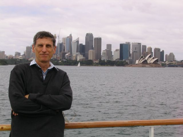
The following week we packed up the RV and took off for the Vail Lake caravan of the LazyDaze club.  Vail is located near Temecula, which is between LA and San Diego, but inland quite a ways.  The weather was perfect.  This caravan was being hosted by our subgroup, the PastTents.  As in, we been there, done that, and will never sleep in a tent again. 

Hosting mostly includes setting up the entry tent to check people in (we had 99 rigs show up), and giving the 8 a.m. announcements over the CB.  I got tagged to do it the second day.  Thanks to my rad treatments, my voice now gives Barry White a run for his money, and my mellifluous ("the dulcet tones of the cello") rumblings were well received, judging by the “who the heck was that?” comments later that day.  A new career?  Hardly.  We broke out the scoot and took a 90 mile ramble up to Mt. Palomar

IMG_2260-1

where we toured the big scope, the museum, and had lunch on the grounds.  That’s one twisty, switchback-happy road up there.  We encountered a troop of CHPs, ten of them riding in formation (5x2) out in the middle of nowhere.  We waved as we passed, but they didn’t move a muscle.  Someone later said they take their new MC officers on these group rides on tricky roads to test their skills.  Hmmm.  They were riding side-by-side, and not staggered, as is the basic safety rule.  So much for taking lessons from our finest.  We had some great vistas from various points along the way:

IMG_2261-1

This is facing west, and amid the haze out there is the Pacific.  We decided to make a big loop drive, so continued south from Palomar.  Lots of vineyards and cattle ranches back there.  I think these have to be some of the most contented cows in the world.  Nice pasture!

IMG_2265

Once back, we settled down to stuffing ourselves at the potlucks, vino-ing, and playing the caravan pastime of ring-toss.  You throw the rings onto an elevated board with three holes in it.  With 5% skill, and the rest luck, the ring might go in one of the 3 (scoring 1, 3, or 5 points depending on which).  Bizarre scoring rules and penalties spice things up.  Loni, who avoided this like the plague during our first couple of years of caravans, got dragooned at Buena Vista earlier this year, and has become a convert. Nice style!  (that’s the disc, on edge, just above her hand)

IMG_2270

We also went into town on Saturday and poked around the shops, had great Mexican for lunch, and listened to the bluegrass festival.  We heard (among others) the Alan Munde guys from Texas who were outstanding.

image

SoCal is really in good shape this year.  Lots of rain, so everything is green, with snow still on the major mountains.  We took a hike from camp and overlooked Vail Lake with, we think, San Gorgonio Mountain in the background.  Part of our scoot ride was in those foothills behind the lake.  Yes, this is SoCal!

IMG_2271-1

Here’s the motley Past Tents crew, courtesy of Barbara B’s camera work (oh, yeah, it was St. Patrick’s day during our stay).

Past_Tents_Gang

No sooner we were back from Vail Lake when we restocked and took off for a smaller gathering (non-caravan) of LazyDazes at Lake Cachuma, in the mountains behind Santa Barbara, near Solvang.  We again had great weather, except for wind the first day.  A group of three jeeps and us on the scoot went out looking for wildflowers.  One of the jeeps was piloted by Art & Barbara, who live in nearby Solvang and who know the back roads.  Did we ever get on back roads!  I doubt I could retrace the route, but we found some spectacular Central Coast scenery like this view:

IMG_2273

We stopped for lunch and bird watching along the way.

IMG_2274 

And we DID find the wildflowers.  We both think this is one of the best displays we’ve ever seen.  California golden poppies and lupen.

Like all of these get-togethers (26 rigs at this one), we ate ourselves silly.  The scoot and carry-rack drew some interest from a couple of folks.  Yesterday, we got a call from one of them – Audrey – who said she had gotten so enthused she went out and bought a classic Vespa and signed up for rider training.  Wow!  Maybe we can get the Jeep contingent to switch.  Nah.

March ended on a good note with my not getting called in at all during my week of jury duty.  Hoorah!  My last time ended in a five-day trial that didn’t start until my fifth day of “on-call.”  Two weeks shot!